


Hurricane Forecaster Advisory

Hurricane Forecaster Advisory의 설명
With this free app you'll get the most recent hurricane and tropical storm forecast information incl. maps, satellite images, podcasts, news feeds, and live radio.
Get access to
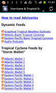
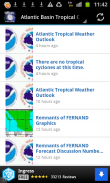
* over 100 advisory live feeds for the Atlantic, Caribbean and the Pacific by NOAA and NHC
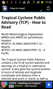
* detailed information on how to read advisories
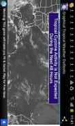
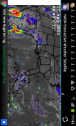
* most recent maps and satellite Images
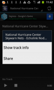
* the National Hurricane Center Skywarn Nets Radio
* audio Podcasts
* and many useful links
Now also available: Tropical Storm feeds and information in Spanish language!
*** Disclaimer ***
The tropical storm and hurricane forecaster advisory information included in this app is based on the latest NOAA, NHC, NASA and other official feeds. They may or may not be the most current forecast available from these official forecasting agencies. Remember to use this as a supplement to official sources only. The devolper of this app is not responsible for its ultimate use in the forecasting of tropical storms.이 무료 응용 프로그램을 통해 당신은 가장 최근의 허리케인과 열대 폭풍 예측 정보를 포함를 얻을 수 있습니다. 지도, 위성 사진, 포드 캐스트, 뉴스 피드, 라이브 라디오.
에 대한 액세스를 얻을
* NOAA 및 NHC으로 대서양, 카리브해 및 태평양 100 자문 라이브 피드를 통해
권고를 읽는 방법에 대한 * 자세한 내용은
* 가장 최근의지도와 위성 사진
* 국립 허리케인 센터 SKYWARN 그물 라디오
* 오디오 팟 캐스트
* 많은 유용한 링크
또한 현재 사용 가능 : 스페인어에서 열대 폭풍우 피드 정보!
*** 면책 ***
이 응용 프로그램에 포함 된 열대 폭풍과 허리케인 예측 자문 정보는 최신 NOAA, NHC, NASA 및 기타 공식 피드를 기반으로합니다. 그들은 수도 있고 이러한 공식적인 예측 기관에서 사용할 수있는 가장 최신의 예측되지 않을 수 있습니다. 유일한 공식 소스에 보충으로 사용하는 것을 기억하십시오. 이 응용 프로그램의 devolper 열대 폭풍 예측의 궁극적 인 사용에 대해 책임을지지 않습니다.


